



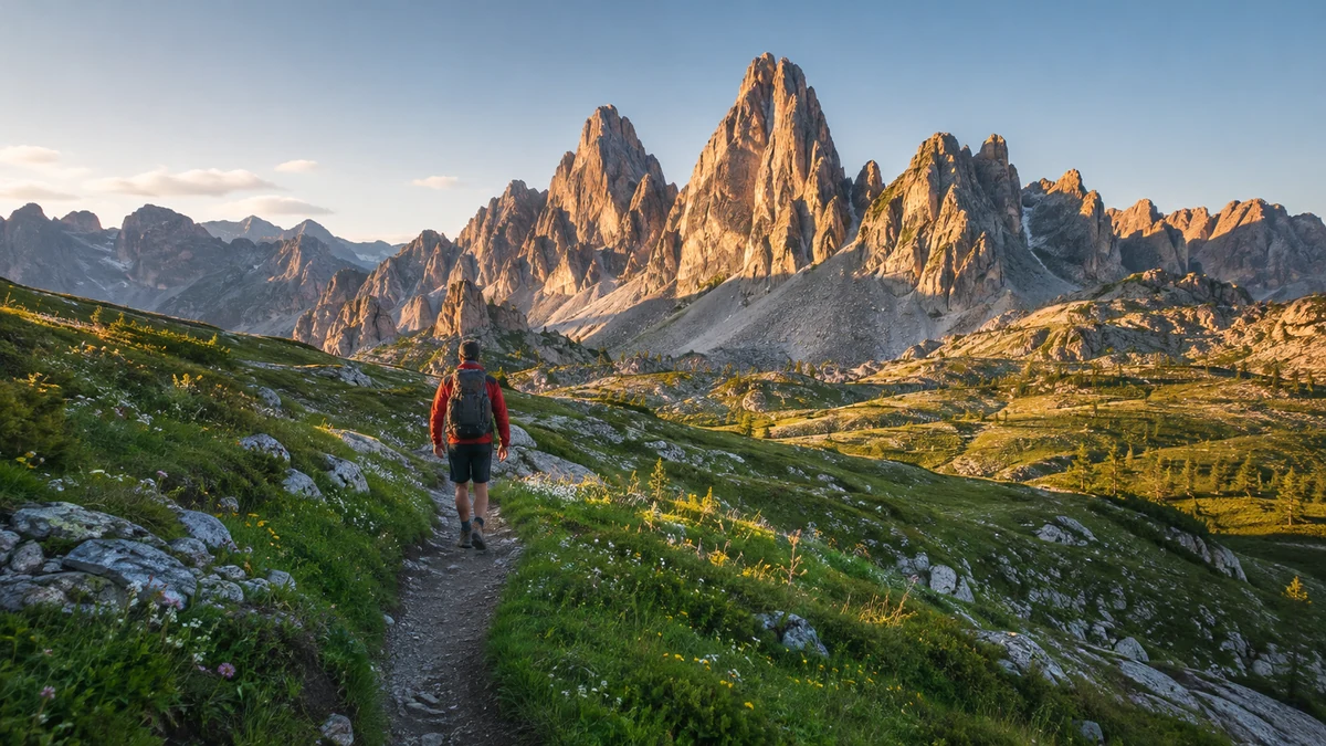
Dolomites hiking was easier to access than I expected, but much harder to plan well. The trails were spread across different valleys, cable cars shaped entire days, parking needed more thought than I had planned for, and a hike marked “moderate” did not always feel moderate once exposure, loose rock, altitude, and tired legs entered the picture.
That was also what made hiking in the Dolomites so memorable.
One morning started in a damp forest with the smell of pine and wet earth around me. Another began above 2,000 meters with jagged limestone peaks already filling the horizon. At Seceda, green meadows dropped beneath the sharp Odle Mountains. Around Tre Cime, everything turned gray, rocky, and almost lunar.
The Dolomites form a UNESCO World Heritage property made up of nine mountain systems. Eighteen peaks rise above 3,000 meters, and the dramatic cliffs, towers, and deep valleys explain why the scenery can change so quickly from one hiking area to another. The UNESCO Dolomites World Heritage page gives useful background before a trip.
After spending time around Val Gardena, Cortina d’Ampezzo, Tre Cime, Seceda, Alpe di Siusi, Lago di Sorapis, and the Odle Mountains, one thing became clear.
The best Dolomites hike was not always the most famous one.
Some iconic places completely lived up to the photographs.
A few felt slightly overrated.
And several quieter trails became the days I remembered most.
Best Dolomites Hikes at a Glance
Distances can change depending on the exact route, cable car used, trailhead, and any side trips. I treated these figures as practical planning numbers rather than expecting every GPS track to match exactly.
| Hike | Approx. Distance | Difficulty | Exposure | Lift? | Best For |
|---|---|---|---|---|---|
| Alpe di Siusi Panorama Trail | 4.5 km | Easy | Very low | Yes | First hiking day |
| Tre Cime di Lavaredo | 10–11 km | Easy–Moderate | Low | No | Iconic scenery |
| Seceda | 10–12 km | Easy–Moderate | Low | Usually | Huge mountain views |
| Adolf Munkel Trail | Around 9.5 km | Easy–Moderate | Low | No | Meadows and rifugios |
| Lago di Sorapis | About 10.5 km | Moderate | Moderate | No | Alpine lake adventure |
| Croda da Lago & Lago Federa | Around 14 km | Moderate | Low–Moderate | No | Quieter scenery |
| Cinque Torri | Variable | Easy–Moderate | Low | Optional | History + easier hiking |
| Puez-Odle Altopiano | Around 16 km | Moderate | Low–Moderate | Yes | Full hiking day |
| Lago di Braies Loop | Around 3.5 km | Easy | Very low | No | Recovery day |
| Sassolungo Circuit | Around 17 km | Moderate–Hard | Moderate | Optional | Long mountain day |
| Vajolet Towers | Route dependent | Moderate–Hard | Moderate+ | Often | Dramatic rock scenery |
For a first Dolomites hiking trip, my strongest three were Seceda, Adolf Munkel Trail, and Tre Cime di Lavaredo.
Alpe di Siusi gave me the best easy day. Lago di Sorapis was the hike I underestimated most. Puez-Odle gave me the strongest feeling of being deep in the mountains rather than moving between famous viewpoints.
1. Alpe di Siusi Was the Perfect Place to Start
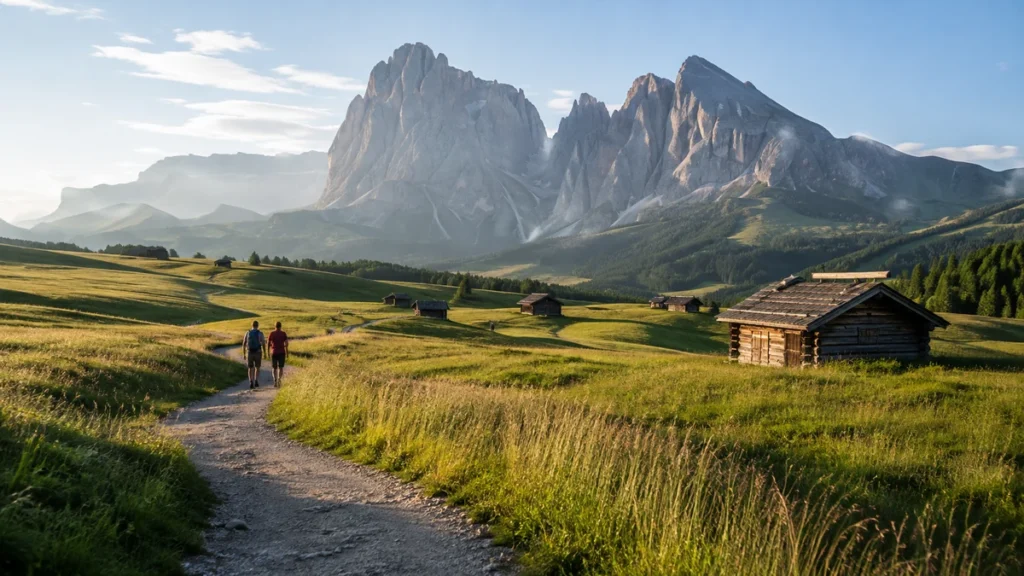
Alpe di Siusi was where the scale of the Dolomites first hit me.
I arrived expecting beautiful meadows and an easy introduction to the mountains. What surprised me was how enormous everything felt.
The grass seemed to roll forever beneath Sassolungo. Wooden huts were scattered across the plateau, and the mountains rose abruptly behind them.
The short panorama route I followed was around 4.5 kilometers with very little climbing compared with the hikes later in the trip.
That made it perfect for day one.
Cowbells carried across the open meadows, sometimes from animals I could barely see. The trail felt relaxed, and for once I was not checking elevation gain every few minutes.
I stopped at a rifugio for something sweet and stayed longer than planned because the terrace faced the mountains.
That became a theme during the trip.
The rifugios were not simply places to refill water or grab food. They became part of the hiking experience.
Alpe di Siusi worked especially well for beginners, families, or anyone looking for easy hikes in the Dolomites without much exposure.
It also taught me something early: not every good hiking day needed to leave my legs destroyed.
2. Seceda Was Famous for a Reason
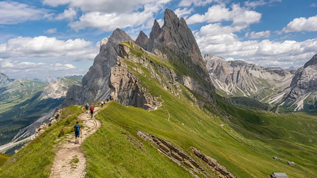
Seceda was one of the few heavily photographed places that still surprised me in person.
I had already seen the ridgeline hundreds of times online.
It did not matter.
The grassy slope seemed to fall away suddenly beneath the jagged Odle Mountains. The contrast between soft green meadow and almost vertical gray rock looked strange even when I was standing directly in front of it.
The main viewpoint was busy.
That was the weakest part.
People gathered around the obvious photo spots, and for a few minutes Seceda felt more like an attraction than a mountain.
Then I kept walking.
Twenty or thirty minutes farther along the trail, the noise started disappearing. The view stayed spectacular, but the atmosphere changed completely.
That became one of the most useful lessons from the trip:
At famous Dolomites viewpoints, walking another kilometer often improved the experience more than arriving another hour earlier.
Seceda also showed why cable cars were so useful in the Dolomites. I could reach high mountain terrain quickly and spend the day walking across ridges and meadows rather than climbing all the way from the valley floor.
3. Adolf Munkel Trail Surprised Me Most
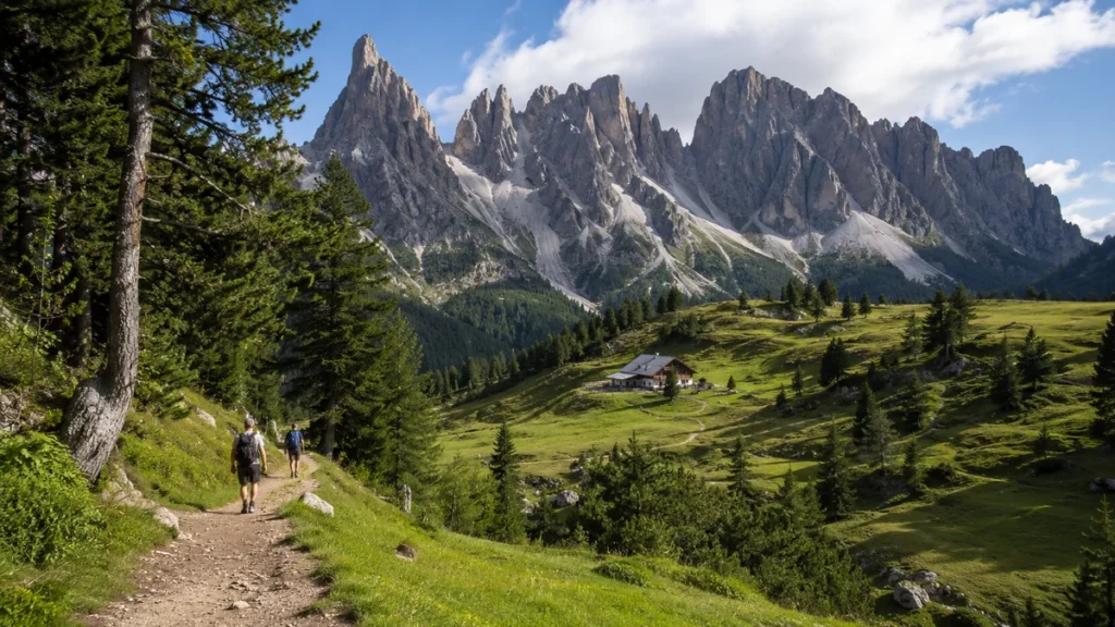
Adolf Munkel was not near the top of my list before the trip.
It ended up near the top afterward.
The trail beneath the Odle Mountains had a very different atmosphere from Seceda.
Much of the early route passed through forest. Tree roots crossed the path. The air smelled of damp soil and pine instead of sun-warmed grass and exposed stone.
Then the trees opened.
The Odle peaks suddenly filled almost the entire horizon.
That moment was more memorable than several viewpoints I had planned weeks in advance.
The route felt manageable rather than easy. By that point, a few days of descents were already sitting in my knees, so even moderate climbing felt different.
Stopping near Geisler Alm slowed the day down.
I sat outside longer than expected and watched clouds move across the mountain face.
Nothing dramatic happened.
That was exactly why the moment stayed with me.
Adolf Munkel never felt like a trail I was completing for a photograph. I could enjoy the forest, the meadows, the mountain huts, and the peaks without rushing toward one famous point.
4. Tre Cime di Lavaredo Was Iconic—but Not My Favorite
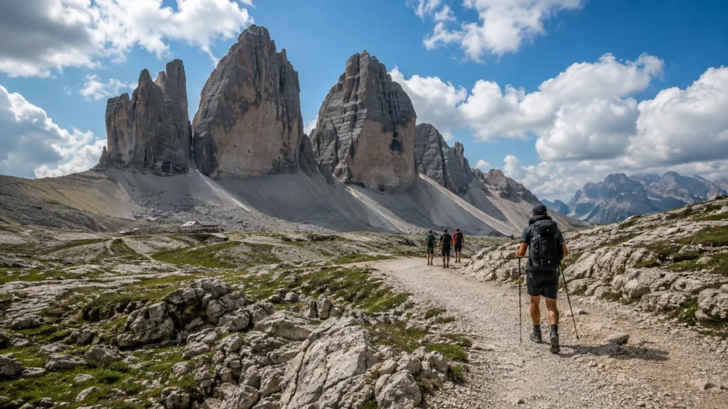
Tre Cime was the hike I expected to love most.
It was not my favorite.
The Three Peaks themselves were extraordinary. Their huge vertical faces looked different from every angle, and the landscape felt much harsher than Seceda or Alpe di Siusi.
There was less green.
More rock.
More scree.
More of that raw, pale Dolomites landscape I had imagined before the trip.
The classic route started around Rifugio Auronzo and passed toward Rifugio Lavaredo and Forcella Lavaredo before continuing around the Three Peaks.
The scenery was never the problem.
The crowds were.
Tre Cime was one of the few places where I stayed constantly aware that I was visiting a major tourist attraction. There were hikers ahead, hikers behind, people stopping for photographs, and busy rifugio terraces.
Still, skipping it completely would have felt wrong.
Tre Cime deserved one day.
It just did not deserve every bit of hype I had given it before arriving.
Tre Cime Parking in 2026
This was one piece of logistics that needed to be sorted before the hiking day.
Private vehicle access to the parking area near Rifugio Auronzo requires an online reservation. The official 2026 rate for a car is €40, and the parking permit is valid for 12 hours from the booked entry time.
I checked the official Tre Cime parking information rather than relying on old blog posts because the access system has changed.
Buses and seasonal shuttles also make it possible to hike Tre Cime without driving all the way to Rifugio Auronzo.
5. Lago di Sorapis Was Harder Than the Photos Suggested
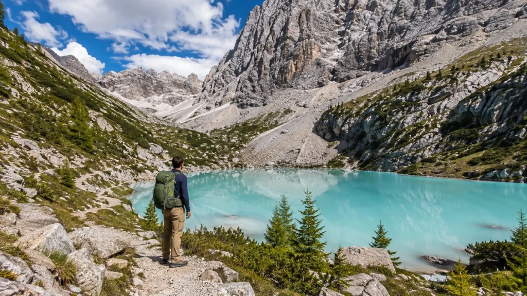
Lago di Sorapis looked gentle online.
Turquoise water.
Gray mountains.
People sitting peacefully beside the lake.
The trail felt different.
The standard route begins around Passo Tre Croci and follows trail 215 toward the lake. The official route is about 10.5 kilometers, and current route information is available through the official Cortina Lago di Sorapis guide.
Some sections were straightforward.
Others demanded much more attention.
There were narrow sections where I stopped looking at the scenery and concentrated completely on my footing. Exposure mattered more here than the distance alone suggested.
That changed how I thought about hiking difficulty.
A trail can be physically moderate but still feel difficult to someone uncomfortable with heights.
Lago di Sorapis was the clearest example of that during my trip.
The lake itself made the effort worthwhile.
The water had a pale blue-green color that looked almost artificial against the surrounding gray rock.
I sat down and pulled out a sandwich that had been flattened at the bottom of my backpack.
It tasted excellent.
Hunger improves mountain food.
For anyone nervous about heights, Lago di Sorapis deserves more thought than its pretty lake photographs suggest.
6. Croda da Lago and Lago Federa Felt More Peaceful
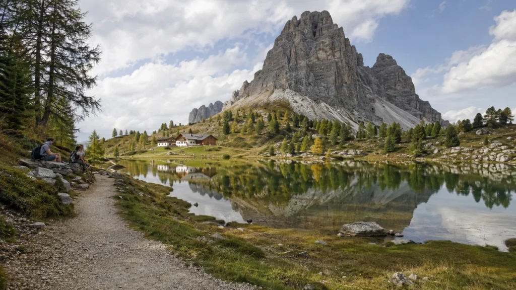
Croda da Lago gave me something I had started missing after several famous hikes.
Quiet.
The trail climbed through forest before reaching the area around Lago Federa and Rifugio Croda da Lago.
The lake felt calmer than Lago di Braies almost immediately.
There were no rows of people waiting around one famous viewpoint and no sense that everyone had arrived with exactly the same checklist.
That changed the entire mood.
I liked this hike because the destination felt earned.
Some Dolomites viewpoints appeared almost immediately after stepping off a cable car. Lago Federa came after enough walking that sitting down near the water felt like arriving somewhere.
The rifugio stop also came at exactly the right moment.
By lunchtime, my legs had worked enough to make a warm meal feel deserved.
For an autumn Dolomites trip, this area becomes even more attractive when the larches begin turning gold.
7. Cinque Torri Was More Than an Easy Hiking Day
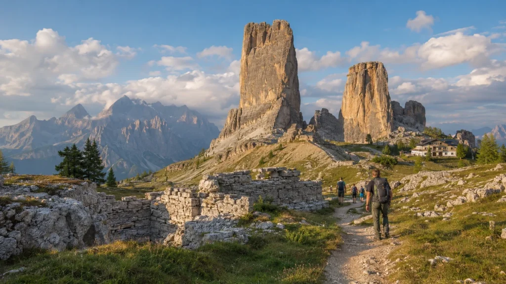
By the time I reached Cinque Torri, my legs needed an easier day.
The area worked perfectly.
A chairlift can remove much of the climbing, while longer routes make it easy to turn Cinque Torri into a half-day or full-day hike.
The towers themselves were dramatic, but what made the area different was its World War I history.
Trails passed old military positions and restored trenches beneath the rock formations.
That gave the day more depth than another mountain viewpoint.
Rifugio Scoiattoli, Rifugio Averau, and Rifugio Nuvolau also made it easy to build the hike around food rather than simply rushing from one viewpoint to another.
Most importantly, Cinque Torri reminded me that recovery days belonged in a mountain itinerary.
Rest was not wasted time.
My legs enjoyed the lesson.
8. Puez-Odle Was My Best Full Hiking Day
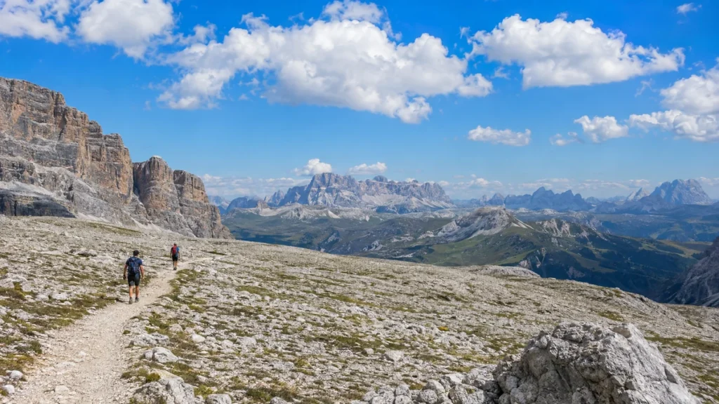
Puez-Odle felt like the proper mountain day I had been chasing.
It was longer, quieter, and more varied than the famous viewpoint hikes.
Green slopes slowly gave way to bare rock and high plateau. In places, the landscape looked almost lunar.
The farther I walked, the fewer people I saw.
That alone changed the experience.
This was also the day when Val Gardena finally made complete sense as a hiking base.
Ortisei, Santa Cristina, and Selva di Val Gardena sat close to a huge network of trails and lifts, making it possible to reach high terrain without spending every morning driving through mountain passes.
Puez-Odle was not especially frightening.
It was tiring.
That distinction mattered.
Several hours of steady walking became the challenge rather than one technical section.
By the time I started descending toward the valley, my legs felt dusty and heavy.
My shirt had dried from sweat more than once.
It was one of my favorite days of the trip.
9. Lago di Braies Worked Better as a Recovery Walk
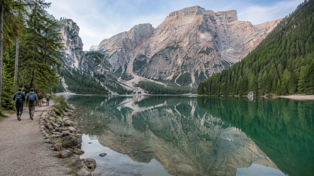
Lago di Braies, or Pragser Wildsee, was beautiful.
It also barely felt like hiking compared with the rest of the week.
The loop around the lake was short and easy, which turned out to be exactly what I needed after several longer days.
Once I stopped expecting Lago di Braies to compete with Seceda, Sorapis, or Puez-Odle, I enjoyed it much more.
The reflections on the water were beautiful.
Forest covered sections of the shoreline.
The perspective changed enough as I walked around the lake to keep the short loop interesting.
The mistake was treating Lago di Braies like the centerpiece of a serious hiking day.
For me, it made more sense as an early-morning walk, a recovery day, or something paired with another nearby stop.
It was worth seeing.
It just was not the hiking highlight of the Dolomites.
10. Sassolungo Was Long, Rocky, and Satisfying
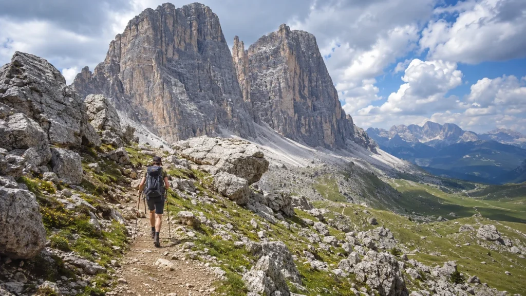
The Sassolungo, or Langkofel, circuit felt like one of the more serious hiking days of the trip.
This was not a trail where I kept pulling out my phone every few minutes.
The mountain dominated the day.
Sections around huge boulders made the scenery feel rougher than the rolling meadows near Seceda.
As the hours passed, distance mattered more than any single climb.
By late afternoon, pace stopped being important.
Getting back comfortably became enough.
That was why Sassolungo made more sense after I had already completed several easier Dolomites hikes.
With only two or three hiking days, Seceda gave me spectacular scenery with far less effort.
With a longer trip and stronger legs, Sassolungo felt much more satisfying.
11. Vajolet Towers Felt Wilder
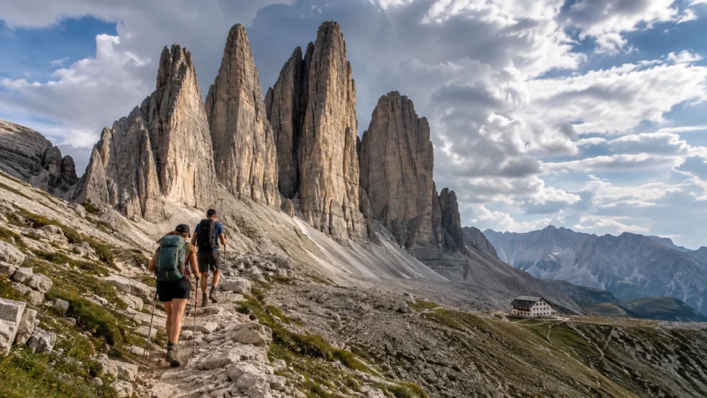
The Vajolet Towers gave me a different kind of Dolomites scenery.
The rock formations felt vertical, rough, and severe.
This was not a hike where every route had the same difficulty.
Lower hiking routes were manageable for experienced hikers, while upper variations became much more serious and could involve scrambling, exposure, or protected sections.
That distinction mattered.
Simply searching for “Vajolet Towers hike” did not tell the entire story.
I checked the exact route before starting rather than assuming every version was suitable.
The atmosphere felt wilder than Tre Cime.
There were still hikers around, but the area never gave me the same feeling of moving through a major attraction.
For hikers who had already seen Seceda and Tre Cime and wanted something rougher, Vajolet Towers made a strong addition.
Where to Stay for Dolomites Hiking
Choosing the right base saved more time than almost anything else.
The biggest mistake in my early planning was thinking of the Dolomites as one compact destination.
They are not.
The mountains are broken up by valleys, passes, and different road systems. Two places that looked close on a map sometimes meant much more driving than expected.
| Base | Best For | Hikes Nearby |
| Cortina d’Ampezzo | Eastern Dolomites | Tre Cime, Sorapis, Cinque Torri, Croda da Lago |
| Ortisei | First western Dolomites trip | Seceda, Alpe di Siusi |
| Santa Cristina | Central Val Gardena access | Seceda, Sassolungo |
| Selva di Val Gardena | Longer western hikes | Puez-Odle, Sassolungo, Passo Sella |
| Dobbiaco/San Candido area | Northern/eastern access | Lago di Braies, Tre Cime region |
Splitting the trip between Val Gardena and the Cortina side made far more sense than repeatedly crossing the Dolomites.
It also gave the trip two different personalities.
Val Gardena felt greener and more connected by lifts.
The Cortina side felt rockier and more dramatic.
Can You Hike the Dolomites Without a Car?
Yes.
A rental car gave me flexibility, but it was not essential for every hiking day.
Val Gardena was especially convenient because lifts operate directly from or close to Ortisei, Santa Cristina, and Selva.
I used the official Val Gardena summer lift information to check operating dates and closing times because individual lifts followed different schedules.
Tre Cime also has seasonal public transport connections.
Without a car, the biggest trade-off was flexibility.
A vehicle made it easier to change plans when the weather shifted.
Without one, buses and lift times became part of the hiking plan.
For a car-free Dolomites trip, staying in one well-connected valley made more sense than trying to collect famous hikes spread across the whole mountain range.
Cable Cars Changed How I Planned Hiking Days
Before visiting the Dolomites, part of me treated cable cars as cheating.
That idea disappeared quickly.
The lifts were part of how hiking worked here.
Instead of spending every morning climbing from the valley floor, I could reach high terrain and spend more of the day walking across ridges, plateaus, and alpine meadows.
That made trails around Seceda and Alpe di Siusi especially useful.
The important lesson was checking the final lift time before starting.
A route built around a cable car changed completely if that cable car stopped running before I returned.
I stopped treating opening hours as a small logistical detail after the first few days.
Best Time for Dolomites Hiking
For a first hiking trip, late June through September gave the simplest combination of open trails, working lifts, operating rifugios, and long enough daylight.
Conditions still changed with altitude and weather.
| Period | What It Usually Means |
| Late June | Green scenery, long days, possible lingering snow higher up |
| July | Most infrastructure operating, growing crowds |
| August | Easy logistics, busiest famous trails |
| September | Cooler mornings, fewer crowds, strong hiking conditions |
| October | Autumn color, more closures, possible early snow |
September gave me the balance I liked most.
The mornings felt cooler, but the trails were generally calmer than the peak-summer images I had seen.
Weather still mattered more than the calendar.
My mistake early in the trip was checking the forecast once at breakfast and treating it as settled.
It wasn’t.
Clouds built faster than expected on several afternoons.
After that, bigger hiking days started earlier.
Before harder routes, I also checked the official Cortina mountain safety guidance, which covers route difficulty, altitude, changing weather, snow, timing, and distances between mountain huts.
What Stayed in My Hiking Bag
My backpack became lighter as the trip went on, but a few things stayed every day:
- Hiking shoes or boots with proper grip
- Waterproof shell
- Warm mid-layer
- Trekking poles
- Water
- Snacks
- Sunscreen
- Sunglasses
- Offline trail map
- Portable battery
- Small first-aid kit
- Some cash for rifugios and small expenses
The trekking poles were the item I nearly left at home.
After several long descents, my knees were very glad they came.
I also carried a layer even when mornings looked warm.
Temperatures changed quickly once clouds moved over the mountains or the trail crossed into shade.
5 Dolomites Hiking Mistakes I Won’t Repeat
Planning Too Many Hard Hikes Back-to-Back
Four big hiking days looked efficient when I built the itinerary.
By the third day, it felt stupid.
My legs were tired before the trail even started.
Alternating long hikes with something easier such as Alpe di Siusi, Lago di Braies, or Cinque Torri made the trip much more enjoyable.
Underestimating the Descent
Elevation gain received most of my attention during planning.
The downhill sections were what my knees remembered.
A hike with a manageable climb could still become exhausting when hundreds of meters of descent came at the end.
Chasing Famous Places Too Aggressively
Tre Cime and Lago di Braies deserved to be seen.
Neither became my favorite experience.
Adolf Munkel, Puez-Odle, and the quieter sections beyond the main Seceda viewpoint stayed with me longer.
I stopped treating popularity as proof that a hike had to be the best.
Ignoring Lift Times
Cable-car closing times were never a minor detail.
A hike planned around a lift became a very different hike once the lift stopped operating.
I checked the final descent time before leaving after learning that lesson.
Rushing Through Rifugio Stops
Early in the trip, lunch felt like something standing between me and the next viewpoint.
By the end, stopping at a rifugio had become one of the reasons I enjoyed hiking in the Dolomites.
A warm meal, a coffee, and twenty quiet minutes looking at the mountains often became more memorable than rushing to another photo stop.
My 5-Day Dolomites Hiking Route
With five hiking days, I kept the geography simple.
Trying to see everything created too much driving and not enough hiking.
| Day | Hike | Why |
| Day 1 | Alpe di Siusi | Easy introduction |
| Day 2 | Seceda | Classic western Dolomites scenery |
| Day 3 | Adolf Munkel Trail | Forest, meadow, and rifugio day |
| Day 4 | Move toward Cortina + Cinque Torri | Easier transition day |
| Day 5 | Tre Cime or Lago di Sorapis | Big eastern Dolomites finish |
With seven days, Croda da Lago and Puez-Odle fit naturally into the trip.
Sassolungo came next if my legs still felt good.
The biggest improvement over my original plan was accepting that fewer hikes could create a better trip.
Day Hiking vs Hut-to-Hut Hiking
My first trip focused mostly on day hikes.
That gave me flexibility.
Bad weather could ruin one day’s plan without disrupting an entire multi-day route, and I could experience both the eastern and western Dolomites during the same trip.
The region also has a strong hut-to-hut hiking culture built around rifugios and famous Alta Via routes.
Alta Via 1 is the route many first-time trekkers encounter first. Alta Via 2 crosses more demanding terrain through mountain groups including Puez-Odle and the Sella Group.
Some longer routes can also involve more exposed terrain or via ferrata sections.
For a first Dolomites visit, day hiking suited me better.
I got to learn how the weather behaved, how my legs handled the descents, and which parts of the mountains I actually enjoyed most.
A hut-to-hut route stopped feeling like something I had missed.
It became a reason to return.
Which Dolomites Hike Should You Choose?
With limited time, choosing by experience made more sense than choosing by Instagram popularity.
| What You Want | Best Match |
| First classic Dolomites hike | Seceda |
| Famous mountain circuit | Tre Cime |
| Easy scenery | Alpe di Siusi |
| Forest + rifugio atmosphere | Adolf Munkel Trail |
| Alpine lake adventure | Lago di Sorapis |
| Quieter full hiking day | Puez-Odle |
| Autumn scenery | Croda da Lago |
| Easier hiking + history | Cinque Torri |
| Recovery walk | Lago di Braies |
| Long mountain day | Sassolungo |
| Wilder rock scenery | Vajolet Towers |
That became my biggest takeaway from Dolomites hiking.
The hardest hike was not automatically the best hike.
Neither was the most famous.
The best days usually had a good rhythm.
An early start.
Changing scenery.
Enough effort to make the hike satisfying.
A long stop at a rifugio.
And enough spare time to sit down when the light hit the mountains properly.
Final Thoughts on Dolomites Hiking
The Dolomites were easier to hike than I expected and harder to organize properly.
Cable cars opened up high mountain terrain without forcing every day to begin with a brutal climb. Rifugios turned lunch into part of the experience. Val Gardena made the western Dolomites remarkably convenient, while Cortina put some of the most dramatic eastern trails within reach.
But good planning mattered.
Weather changed.
Parking needed preparation.
Lift schedules controlled certain routes.
And trail difficulty could not be understood from distance and elevation gain alone.
Exposure, terrain, descent, crowds, and tired legs changed how each hike actually felt.
If I planned the trip again, I would spend less time chasing famous viewpoints and more time on the trails between them.
Tre Cime gave me the photograph I expected.
Adolf Munkel gave me the day I kept thinking about afterward.
And that was probably the most useful thing the Dolomites taught me:
Sometimes the best part of the hike starts after the must-see viewpoint is already behind you.